🌍 Air Quality Research: A Case Study of Romania
Advanced Environmental Monitoring & Analysis
Spatiotemporal Analysis of Land Cover Correlation and Population Exposure
A comprehensive geospatial research project examining the complex relationships between air quality, land use patterns, and population exposure across Romania. Using advanced GIS techniques, remote sensing data, and atmospheric modeling, we analyze decade-long trends in key air pollutants and their environmental determinants to support evidence-based environmental policy and public health initiatives.
Comprehensive temporal analysis of air quality trends from 2013-2022 using CAMS atmospheric monitoring data
Simultaneous analysis of NO₂, PM2.5, and PM10 concentrations across diverse Romanian landscapes
Quantitative assessment of air quality exposure risks for 19.3 million Romanian residents
Air pollution represents one of the most pressing environmental challenges of the 21st century, with significant implications for public health, ecosystem integrity, and climate change. This research project employs advanced geospatial analysis techniques to investigate the spatiotemporal patterns of air quality across Romania, focusing on three critical pollutants: Nitrogen Dioxide (NO₂), Fine Particulate Matter (PM2.5), and Coarse Particulate Matter (PM10).
Our study integrates multiple high-resolution datasets, including Copernicus Atmosphere Monitoring Service (CAMS) atmospheric composition data, European Space Agency Climate Change Initiative (ESA CCI) land cover classifications, and WorldPop demographic information. Through rigorous spatial analysis, we examine how different land use patterns—urban development, agricultural practices, forest coverage, and industrial activities—correlate with pollutant concentrations and subsequently affect population exposure levels.
The research methodology combines traditional GIS techniques with modern web-based visualization tools, creating an interactive platform that enables stakeholders to explore air quality patterns at multiple spatial and temporal scales. This approach facilitates evidence-based decision-making for environmental policy, urban planning, and public health interventions.
Develop comprehensive maps showing air quality variations across Romania's diverse geographical regions and temporal trends over the past decade.
Quantify relationships between different land use types and pollutant concentrations to identify environmental drivers of air quality.
Calculate population-weighted exposure indices to identify vulnerable communities and inform targeted public health interventions.
Generate evidence-based recommendations for air quality management strategies and environmental policy development.
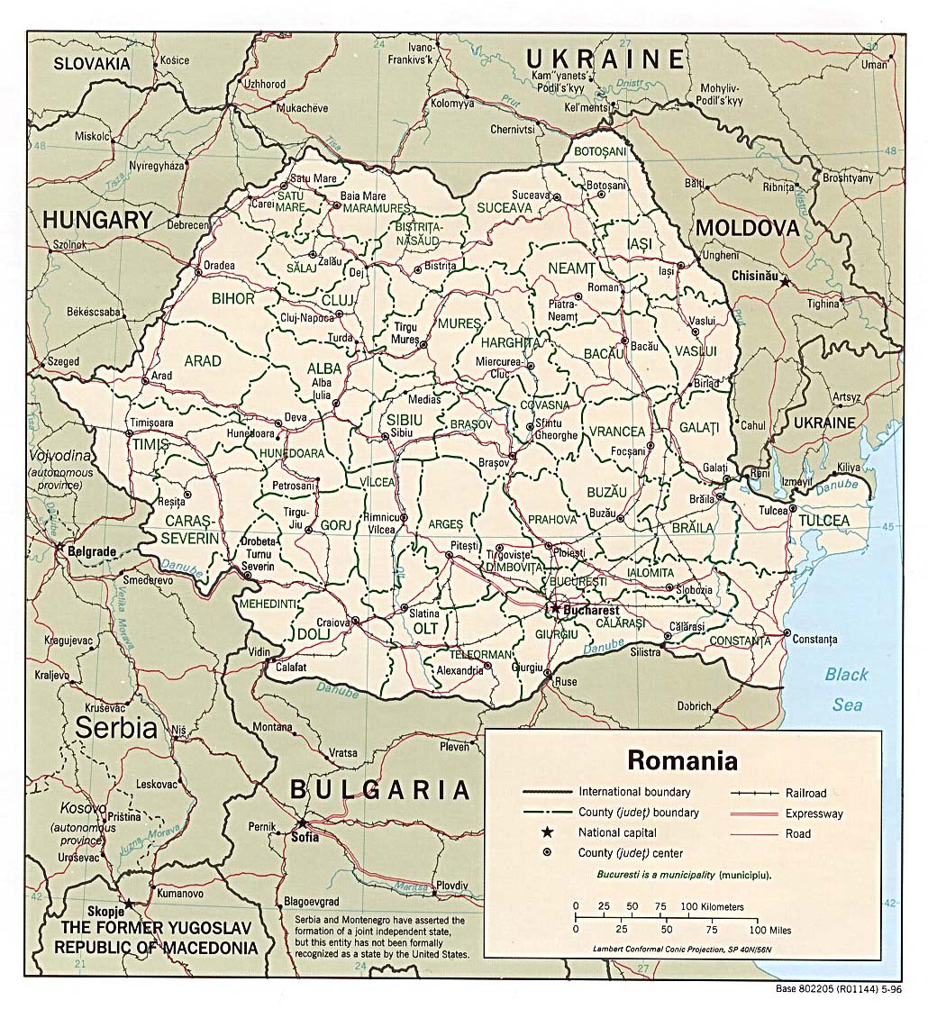
Figure 1: Romania study area showing administrative boundaries, major cities, and diverse geographical features. Source: Administrative boundaries from Eurostat, 2025
Romania serves as an ideal case study for air quality research due to its diverse geographical characteristics, ranging from the Carpathian Mountains to the Danube River Delta, and its complex mixture of urban, industrial, and rural landscapes. The country's location in Southeastern Europe positions it at the intersection of various atmospheric transport patterns, making it particularly susceptible to both local pollution sources and transboundary air quality impacts.
With a population of approximately 19.3 million inhabitants distributed across 238,391 km², Romania exhibits significant spatial heterogeneity in population density, land use patterns, and economic activities. Major urban centers including Bucharest, Cluj-Napoca, Timișoara, and Constanța represent areas of high population concentration and industrial activity, while extensive rural areas maintain predominantly agricultural land use with lower population densities.
The country's air quality challenges stem from multiple sources: vehicle emissions in urban areas, industrial activities concentrated in specific regions, agricultural practices including seasonal biomass burning, and residential heating primarily using solid fuels in rural areas. These diverse pollution sources create complex spatial patterns that require sophisticated analytical approaches to understand and address effectively.
Complete national territory (238,391 km²) with high-resolution spatial analysis
19.3 million inhabitants across urban and rural settlements
2013-2022 decade-long analysis period with monthly temporal resolution
0.1° × 0.1° grid cells (~11 km) for atmospheric data integration
Our research employs a comprehensive multi-stage methodology that integrates remote sensing, atmospheric modeling, and advanced geospatial analysis techniques. The approach follows established protocols for environmental monitoring and spatial analysis, ensuring reproducibility and scientific rigor while addressing the complex challenges of air quality assessment at national scale.
Collection of multi-source datasets including CAMS atmospheric data, ESA land cover, and WorldPop demographics
Geometric correction, temporal aggregation, and spatial harmonization of all datasets to common projection and resolution
Zonal statistics, correlation analysis, and bivariate mapping to identify relationships between variables
Interactive web mapping and statistical visualization for comprehensive results presentation
The research utilizes several authoritative datasets that provide comprehensive coverage of atmospheric composition, land use patterns, and demographic distributions. Each dataset has been selected based on its temporal coverage, spatial resolution, and scientific validation to ensure the highest quality of analytical results.
European Centre for Medium-Range Weather Forecasts (ECMWF) Copernicus Atmosphere Monitoring Service providing validated atmospheric composition data with global coverage
European Space Agency Climate Change Initiative Land Cover maps with 300m resolution, providing detailed classification of land use types
High-resolution population distribution data at 100m resolution, enabling precise population exposure calculations
Official Romanian administrative boundaries from Eurostat, ensuring accurate spatial delimitation and policy relevance
The analytical framework employs a hierarchical approach, beginning with individual pollutant analysis and progressing to integrated multi-pollutant assessments. Statistical analysis includes correlation coefficients, regression analysis, and spatial autocorrelation measures to identify significant relationships between air quality and environmental variables.
Population exposure assessment utilizes population-weighted concentration indices, calculating the number of people exposed to different pollution levels according to World Health Organization (WHO) and European Union (EU) air quality standards. This approach enables identification of vulnerable populations and supports targeted public health interventions.
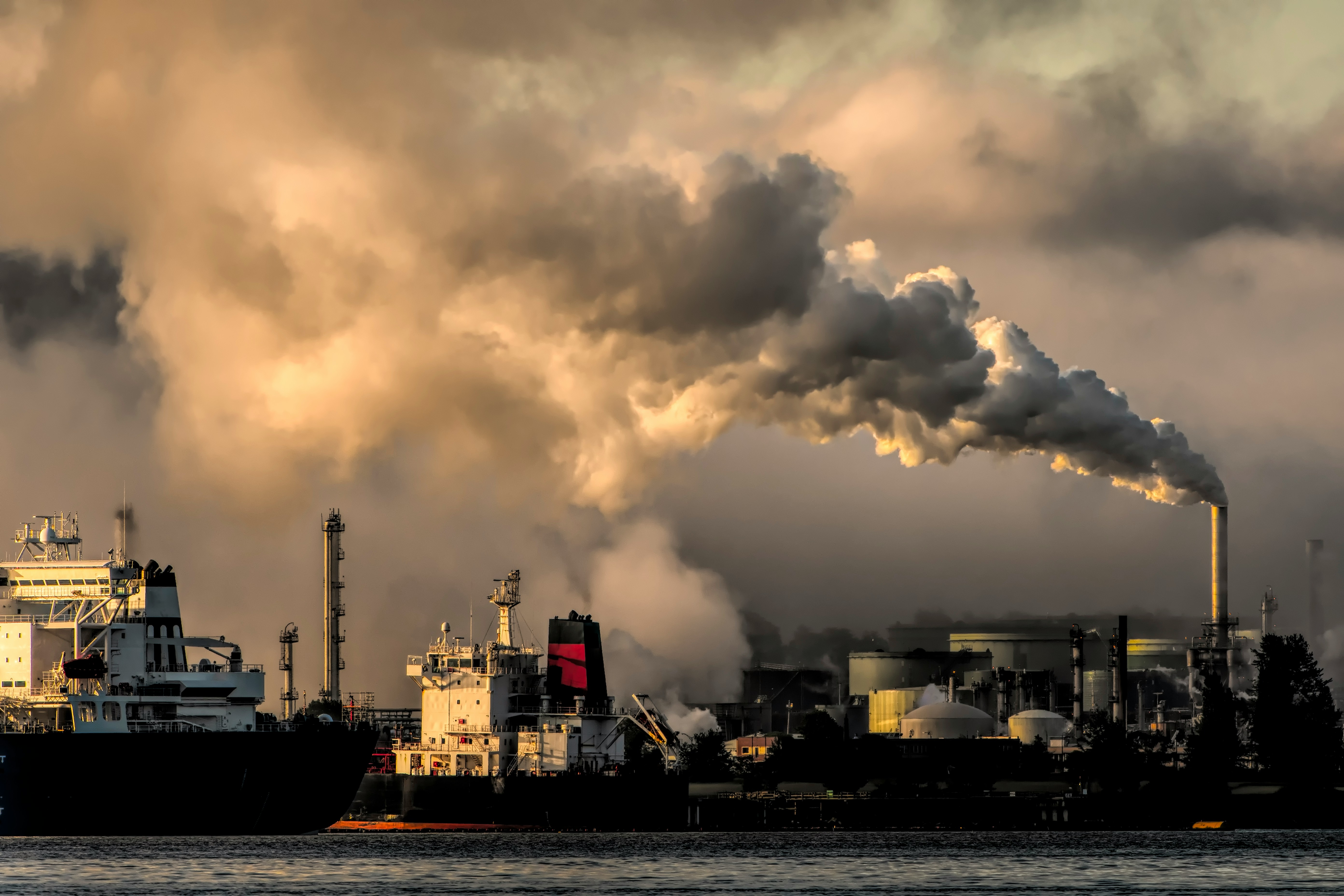
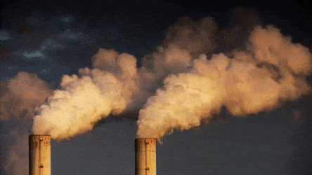
Figure 2: Urban air pollution in Romania highlighting the critical need for comprehensive monitoring and analysis of atmospheric pollutants.
Air quality degradation represents a critical environmental and public health challenge across Europe, with Romania experiencing some of the continent's most significant air pollution burdens. According to the European Environment Agency, Romania consistently ranks among EU member states with the highest levels of particulate matter and nitrogen dioxide concentrations, particularly in urban and industrial areas.
The health implications of air pollution exposure are well-documented, with fine particulate matter (PM2.5) and nitrogen dioxide (NO₂) linked to cardiovascular disease, respiratory conditions, and premature mortality. The World Health Organization estimates that air pollution contributes to approximately 7 million premature deaths globally each year, with Eastern European countries experiencing disproportionately high rates.
This research addresses critical knowledge gaps in understanding the spatial patterns of air quality across Romania and their relationships with land use characteristics. By integrating high-resolution atmospheric monitoring data with detailed land cover information, the study provides unprecedented insights into the environmental drivers of air pollution and their implications for population health.
The findings from this research contribute to multiple domains including environmental science, public health, urban planning, and policy development. The interactive visualization platform developed as part of this project enables stakeholders to explore air quality patterns and make informed decisions about environmental management strategies.
Our interdisciplinary research team brings together expertise in environmental monitoring, geospatial analysis, and atmospheric sciences. Each team member contributes specialized knowledge and technical skills to ensure comprehensive analysis of air quality patterns and their environmental determinants.


This collaborative research represents the culmination of advanced geospatial analysis techniques and environmental monitoring expertise. Each team member brings unique perspectives and technical capabilities, ensuring comprehensive analysis of air quality patterns and their environmental determinants. The project demonstrates the integration of traditional GIS methodologies with modern web-based visualization technologies to address pressing environmental challenges.